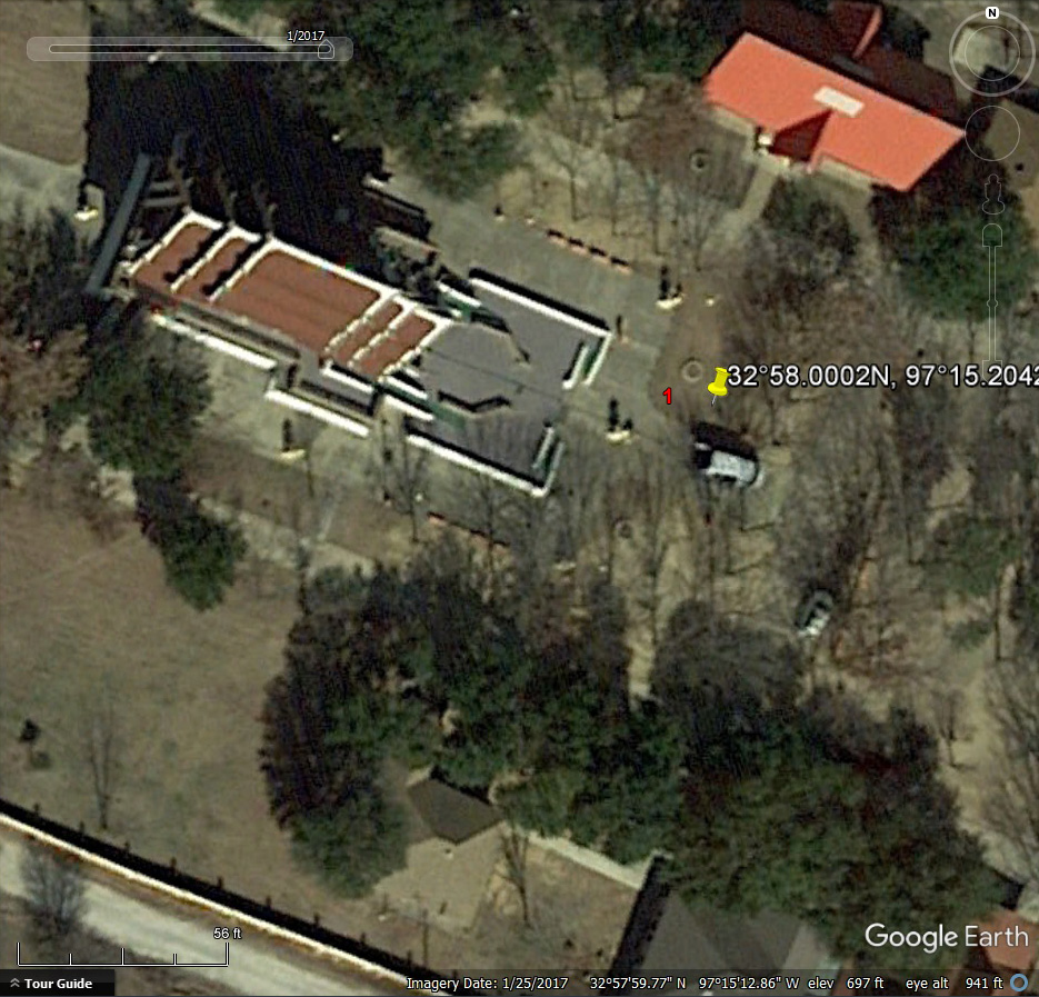
The tripod is at the camera location for the four camera GPS test in the previous article. Buddhist Temple, Keller Texas.
Over a period of time Google Earth records multiple satellite images of the same area. You can cycle through those images. You would think the same identical GPS coordinates would show up on the same location in the images as you go back through time, but that is not the case.
(This article is a sequel to the previous article. This article will make more sense if you read that one first.)
I made this discovery when I wrote the previous article. As I went back through time the same GPS coordinates show up at different locations on Google Earth’s satellite images.
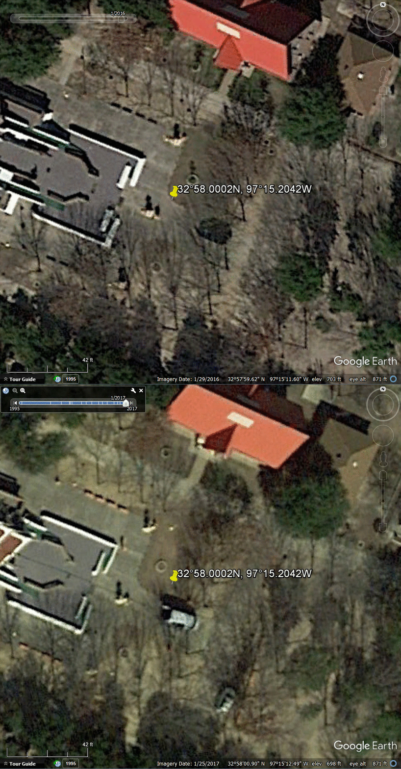
I did the screen captures in Google Earth for the prior article back on March 9. Back then Google Earth was using a 2016 satellite image with vivid colors. After writing the previous article I dropped the same coordinates from the Canon 5D Mark III photo into Google Earth again and they are now using a 2017 satellite image with much more subdued colors. But the real surprise is the yellow pin changed locations. With the 2016 satellite image, the GPS coordinates for the Canon 5D Mark III (the red “1” in the image above) are southwest of the ornamental circle around the tree. With the 2017 satellite map the same GPS coordinates (yellow pin) have moved est to a location southeast of the circle around the tree.
You can check this out for yourself. Enter a set of GPS coordinates into Google Earth and wait for Google earth to find the location and drop the yellow pin. Zoom in on the image for a closer view of the area. Click on the little clock at the top of the page to open the time slider. As you change the time of the satellite images the image will move around under the yellow pin, changing the location of the pin on the image. Changing from one satellite date to the next should look something like the animated GIF above as the image moves under the yellow pin from 2016 to 2017.
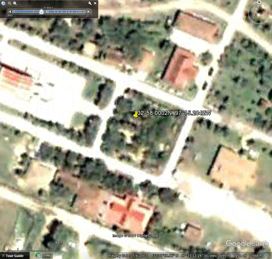
How much variation does Google Earth have in the placement of the same set of GPS coordinates? Using the same GPS coordinates I went through every satellite image from 1995 to 2017. The yellow pin jumps around in every image but generally within the same 30 foot area (which is typical for civilian satellite accuracy). But in the 2003 satellite image the yellow pin was off by about 90 feet from where it is in the other satellite images.
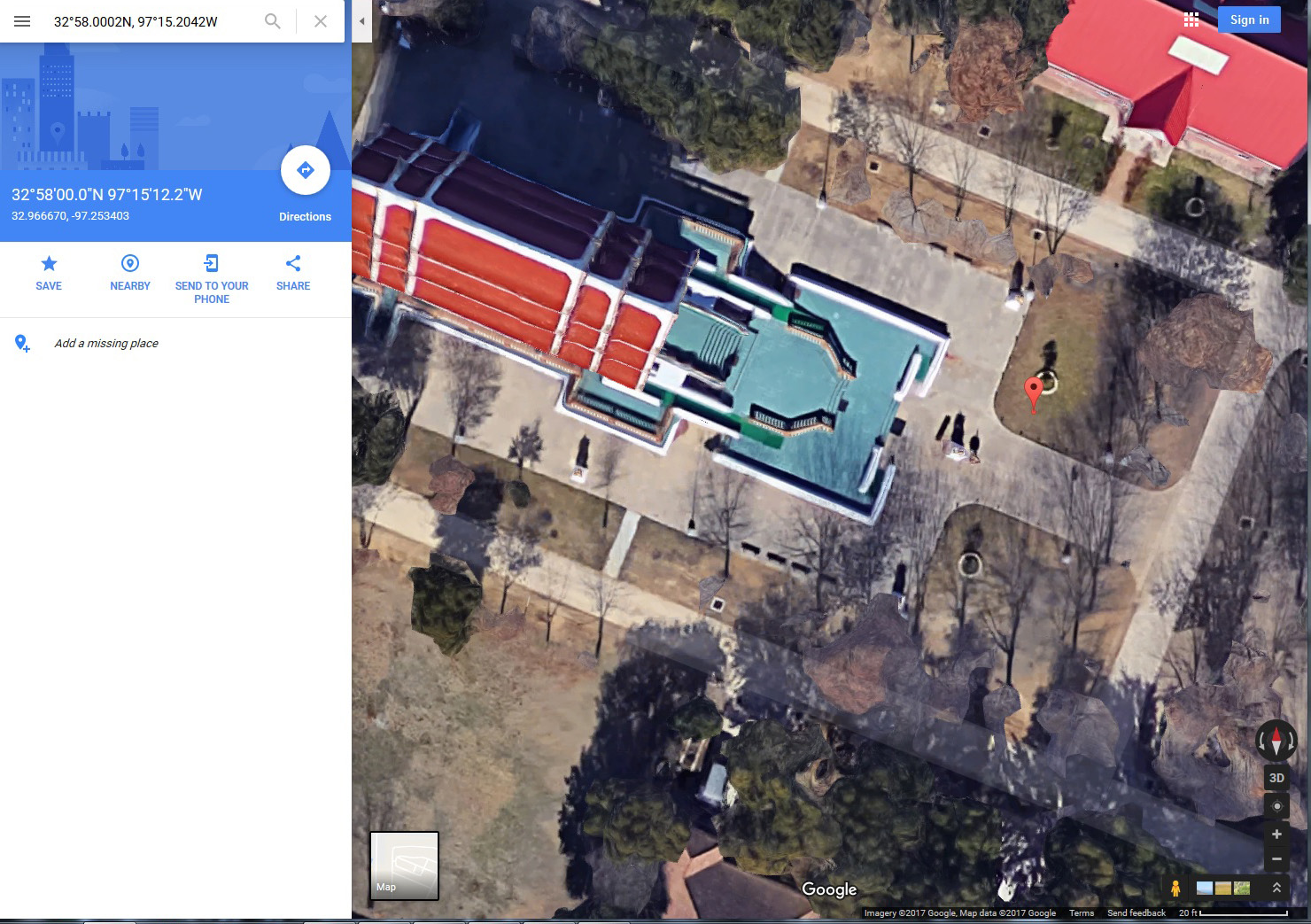
Canon 5D Mark III GPS coordinates (red pin) in Google Maps. Buddhist Temple, Keller Texas. Click for a larger version.
The 2016 satellite image I used for the screen captures for the previous article is no longer available on Google Earth. Google Earth is now using a different 2016 image when you go back in time. However the colorful satellite image is still available on Google Maps. If you drop the coordinates from the Canon 5D Mark III photo into Google Maps today, the red pin is in the same location as the yellow pin in the Google Earth satellite image I used back on March 9. Curious.
All of this just emphasizes the point of the last article. When you pull the GPS coordinates out of one of you photos and drop it into Google Earth, Google Maps, or any other mapping program, you are going to get an approximation of where your camera was actually located when you took the photo. Usually the location on the map or satellite image will be withing 30 feet of your actual camera location, but every once in a while it could be off by 100 feet or more.
Links

