How do you figure out the names of mountains you don’t know? It is relatively simple. I will show you how.
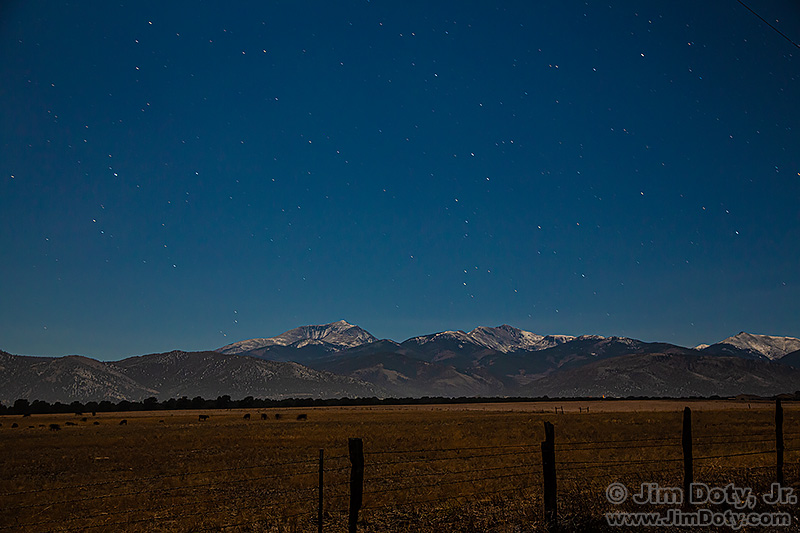
Ten years ago last night (October 26-27, 2012), my brother John and I were about a mile north of Poncha Springs Colorado. It was around midnight and we had a bright moon high in the sky. John was taking in the view and I was pointing my tripod mounted camera several different directions and taking pictures by moonlight.
To the southwest of our location we immediately recognized Mt. Ouray from childhood trips to O’Haver Lake, but we did not know the names of the other two mountains. The simplest way to figure that out was to drop the GPS coordinates of our photo location into the location box at peakfinder.org. Peakfinder will show you the mountains and their names in a drag-able 360° line drawing.
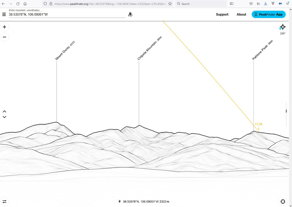
With our location coordinates entered in the box at the upper left (Peakfinder automatically converted the format of the GPS coordinates), I dragged the line drawing until I saw the view to the southwest. There were the names of the mountains in my photo, Mt. Ouray, Chipeta Mountain, and Pahlone Peak. Simple.
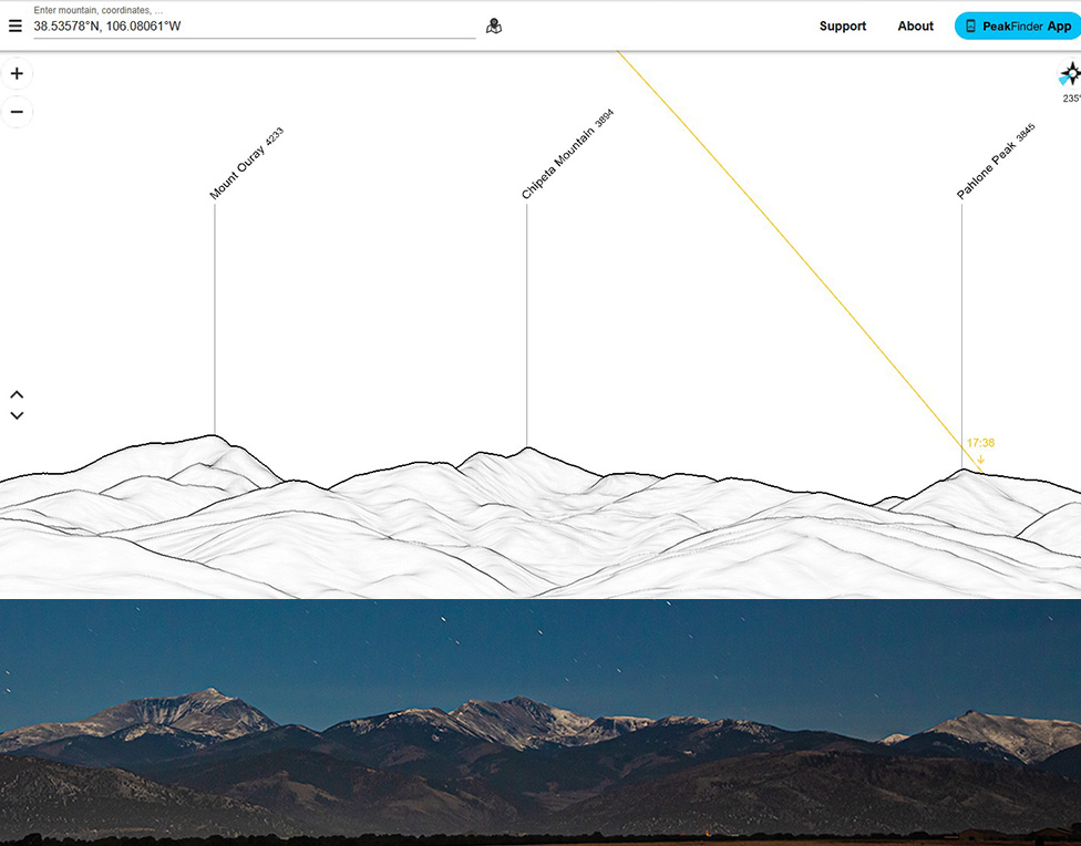
I cropped the mountain part of my photo and did an overlay with the Peakfinder drawing. The line drawing in Peakfinder is a very good match to my photo.

Peakfinder makes it simple provided you know the GPS coordinates when you take your photo. My DSLR does not have GPS capability, but most smartphones do. Sometimes I take a photo of the same scene with my iPhone and get the GPS coordinates from the matching iPhone photo. It was too dark for my iPhone to take a picture of the mountains (iPhone photos at night have gotten a lot better since 2012), so I opened the “GPS Location” app on my iPhone and did a screen capture after I finished taking pictures with my DSLR.
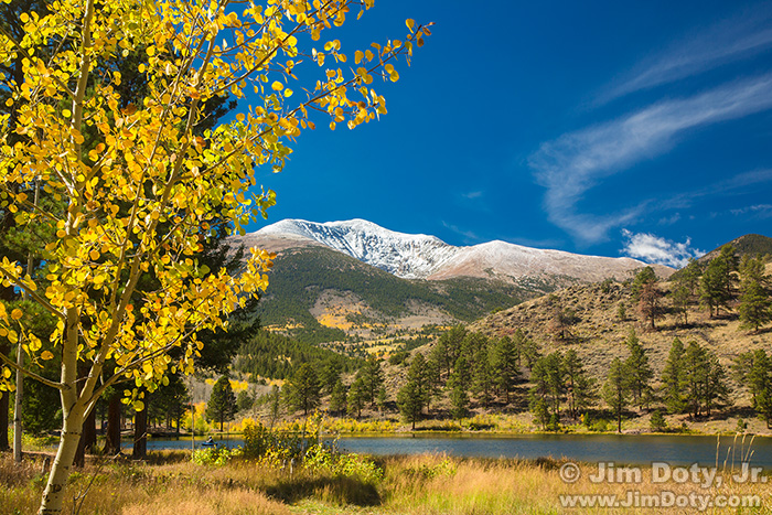
If you find yourself in the Salida/Poncha Springs area, O’Haver Lake is a nice place to camp/and or take pictures. Nearby Marshall Pass is a beautiful drive in the fall.
Photo Data: Canon 5D Mark III camera, Canon EF 24-105mm lens at 45mm, aperture f/5.6, shutter 30 seconds, ISO 800.
Links
Fall Color Photography Guide to Marshall Pass and O’Haver Lake, Colorado