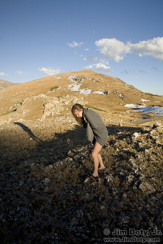
A chance look today at an old photo just sent me back in time, both photographically and technologically. It was bone chillingly cold and Sarah and I were doing figure studies high in the Colorado Rockies. (One of our images is at the end of this article.) Back in 2007 most cameras did not have built in GPS units and my primitive mobile phone did not have GPS capabilities either. But I still wanted to keep track of some important photo locations, and this spot was one of them.
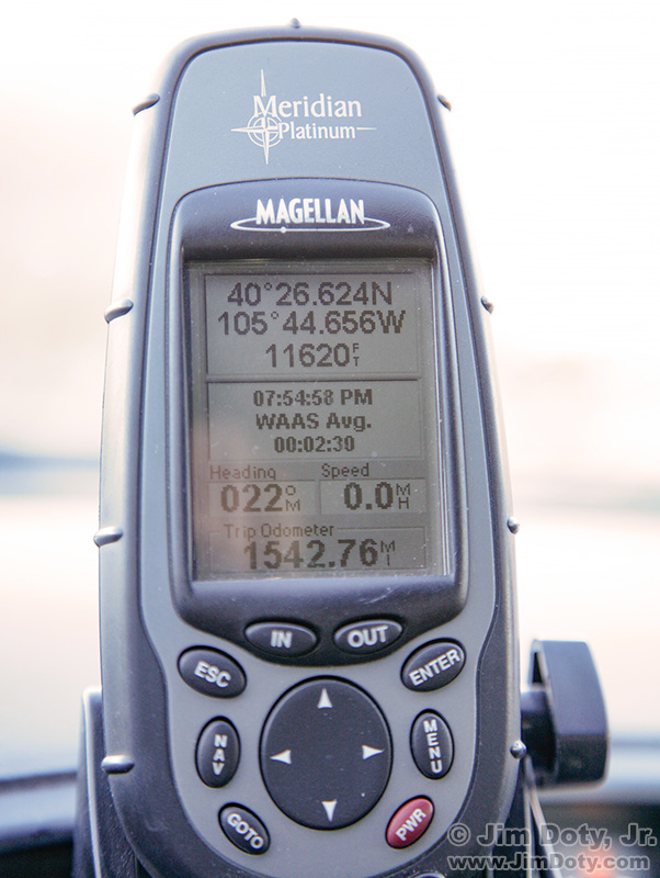
Magellan GPS with our location.
My solution was simple. At the end of the photo session I took a picture of the GPS unit sitting on the dash of the car. That way a photo of our GPS coordinates was with the images we had just created. As you can see, we were at 11,620 feet in elevation. When I downloaded the photos, this GPS photo ended up in the same folder as the images of Sarah. The car was not far from where we were shooting so the coordinates were close enough.
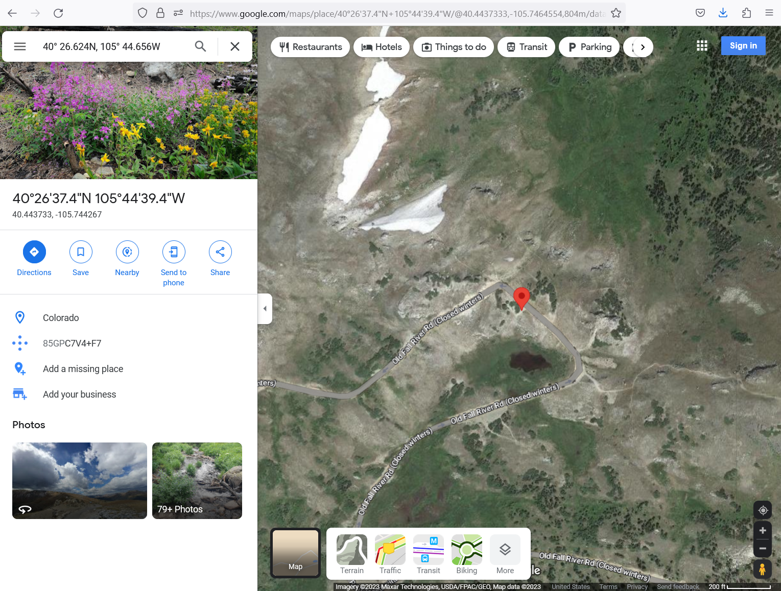
It is a simple matter to enter GPS coordinates into an online map site or a downloadable GPS mapping program. I dropped the GPS coordinates into the search bar at Google Maps.
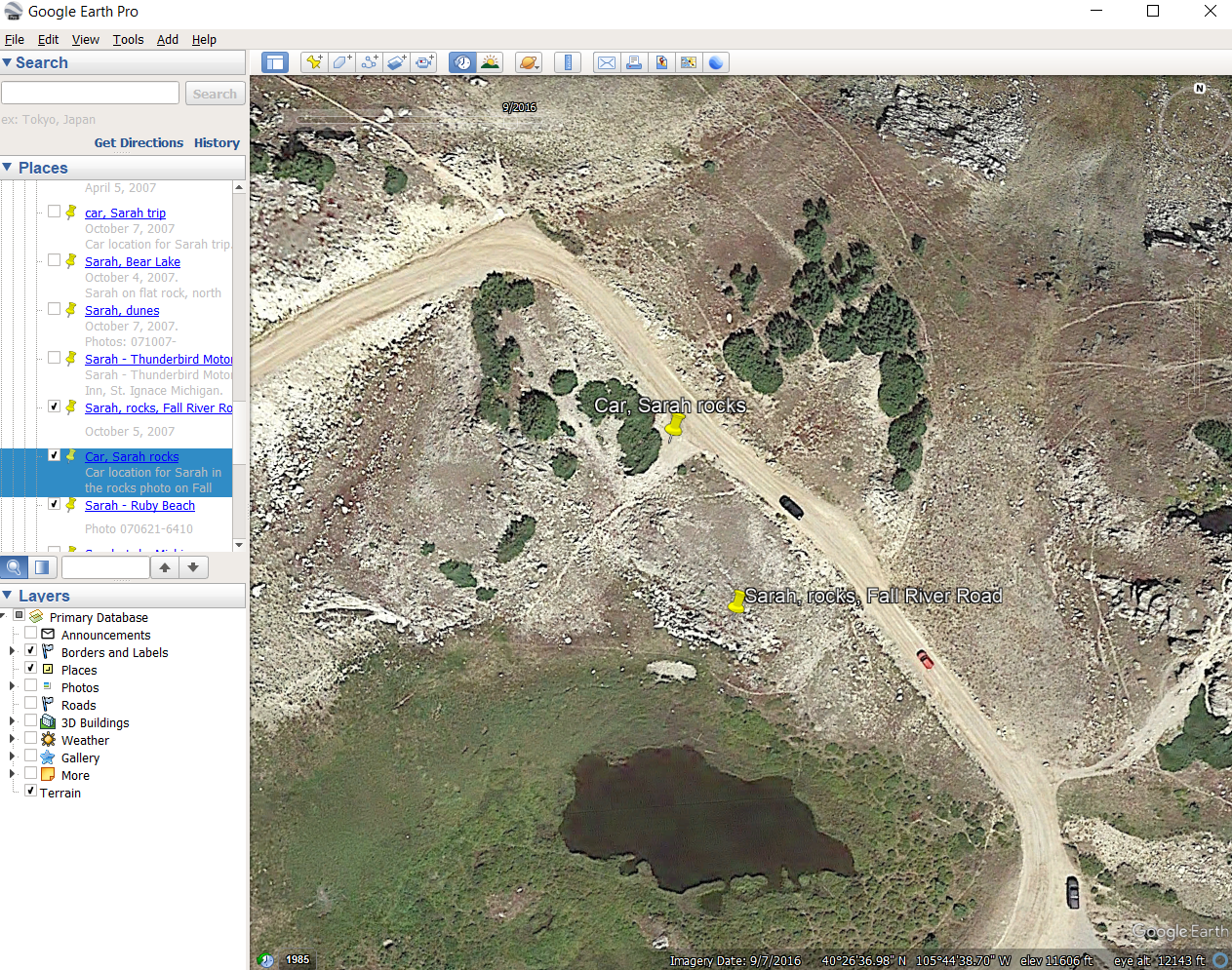
I prefer a program that allows me to name and save locations. My favorite GPS software is Google Earth Pro and it is a free download. I entered the GPS coordinates into Google Earth Pro and the software dropped a yellow pin on the location of our car. I named the pin “Car, Sarah rocks” and had Google Earth Pro save the location. I also manually dropped another pin at the approximate location in the rocks where Sarah was standing when we created our images.
If I wanted to keep track of a location that was much farther from the car, I had a small, pocket sized GPS unit I carried with me.
Now my phone functions as my GPS unit. One of my two primary DSLR cameras does not have GPS capabilities. If I want GPS coordinates of a photo location taken with that camera, I just take a picture with my iPhone at the same location and it saves the GPS location with the iPhone image. I also have a GPS mapping app on my phone.
If your camera does not record GPS locations and your phone doesn’t either, you can always go old school and carry a small and inexpensive GPS unit to keep track of your photo location. Just take a picture of the coordinates before you move on to the next location.
For a series of articles on using GPS in photography, check the link below.
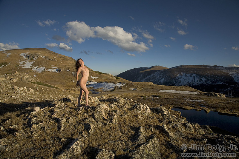
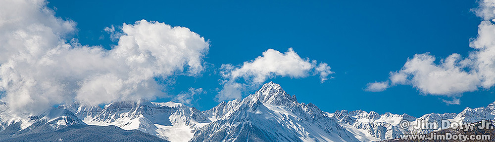
This is one of our favorite images at this location.
Link