How far was I from this burning building that I photographed last night for the local newspaper? My initial guesstimate was between 300 and 400 yards. The actual distance was 356 yards, more or less. How I did I figure that out?
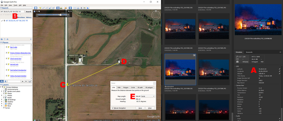
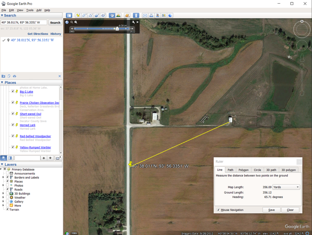
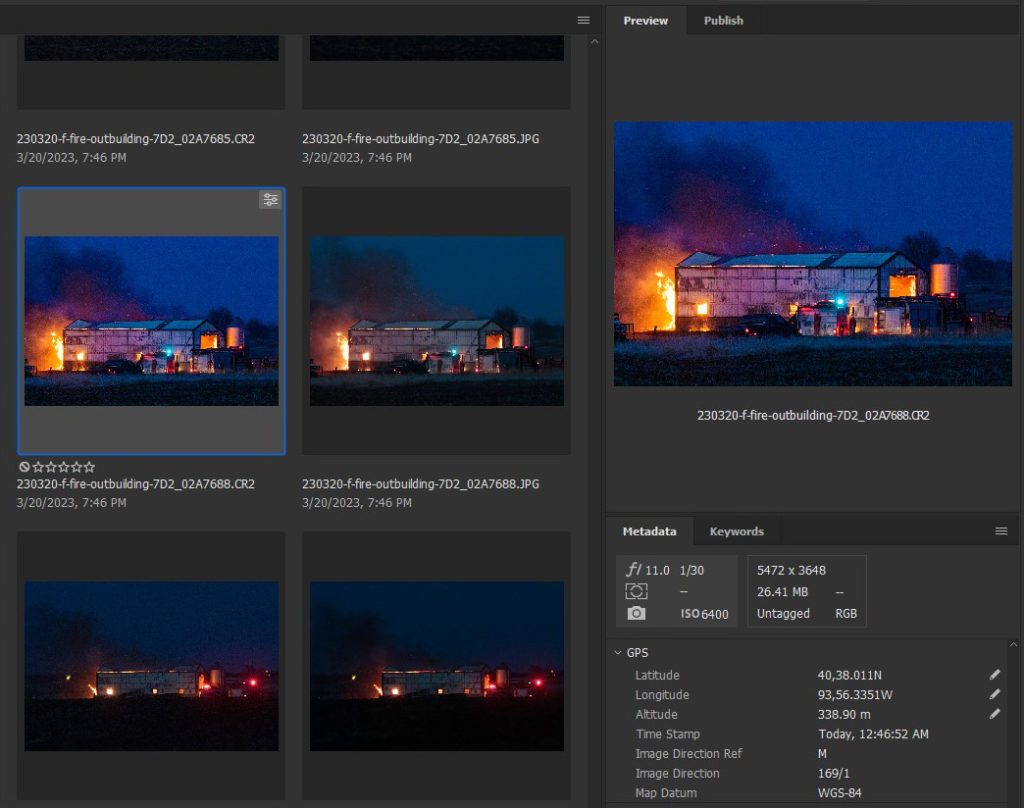
With Adobe Bridge (partially visible on the right) opened to the folder with my fire photos (a total of 41 photos), I selected the photo I sent to the local newspaper (the file name ends with 7688). Then I opened Google Earth Pro (which is a free software download) and put it on top of Adobe Bridge (on the left). I copied the GPS coordinates from Adobe Bridge (Red A), and dropped them in the search box (Red B) in Google Earth Pro, and clicked “Search”. Google Earth Pro zoomed in on the location and dropped a yellow pin at my photo location (Red C). I chose the ruler tool in Google Earth Pro and drew a line (it is yellow) from my photo location to corner of the building that was burning. The ruler tool said that distance was 356.09 yards (Red E).
The ruler tool is very accurate. The variable is the GPS coordinates from my camera. Consumer grade GPS coordinates can be off by as much as thirty feet. But in this case the yellow pin is right on the side of the road where I was located. So, allowing for a bit of GPS error, 356 yards is within 10 or so feet from my actual distance to the building.
If you are fascinated by this kind of thing, I have a whole series of articles on using GPS in photography at my photo blog. Click the link below.
Link


