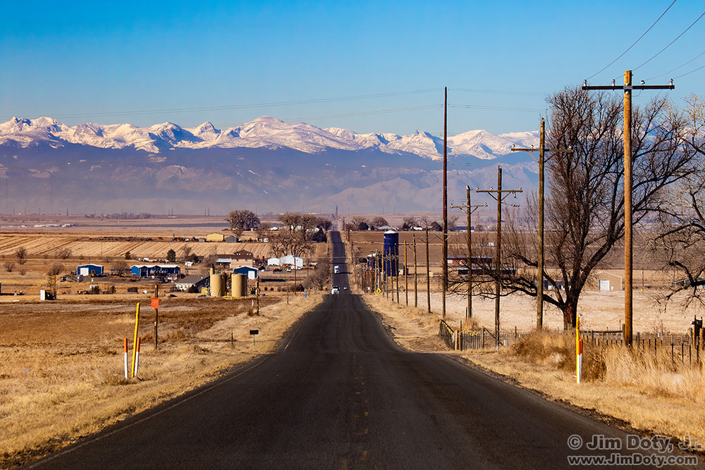
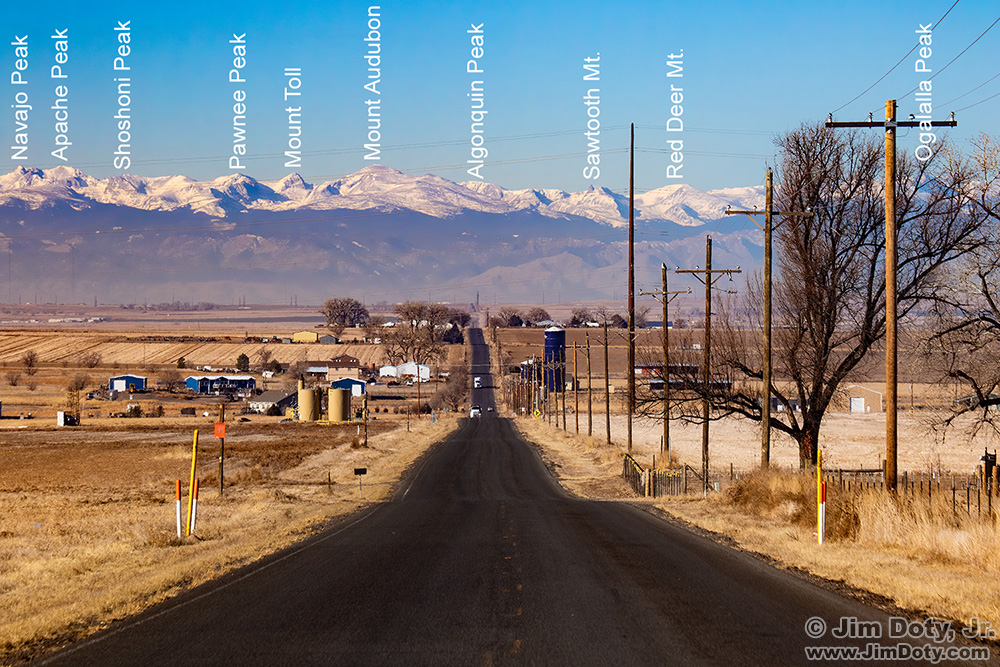
I have always loved the view of the Colorado Front Range as I approach the mountains from the eastern plains. I was going to stop in Keenesburg Colorado to get gas, so on that stop I found this county highway northwest of town to take a picture of the mountains. Back home at my computer I decided to figure out the names of some of these mountains.
The simplest way to do that is to drop the GPS coordinates of a photo into PeakFinder.com. Both my Canon 7D Mark II and my iPhone record the GPS location of every photo I take. But my Canon 5D Mark III (5D3) does not. When I use the 5D3 and want to know the GPS location for those photos later on, right after I take the 5D3 photos, I take one quick iPhone photo at the same location so I have the GPS coordinates.
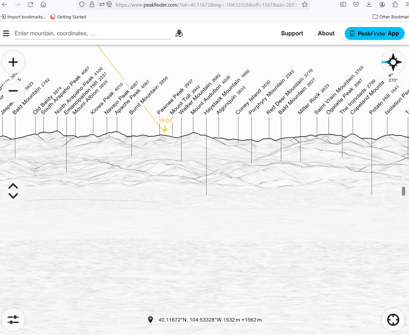
After you enter the GPS coordinates into PeakFinder, you will see a line drawing of the mountains and hills from your viewing location. Grab the drawing and drag it right or left until you are looking at the same direction you were facing when you took your photos. You can zoom in and out on the line drawing to go to a wider or narrower angle of viewer. A narrower angle shows you more mountain names than a wider view. In this screen capture PeakFinder is showing me a much wider view than my photo.
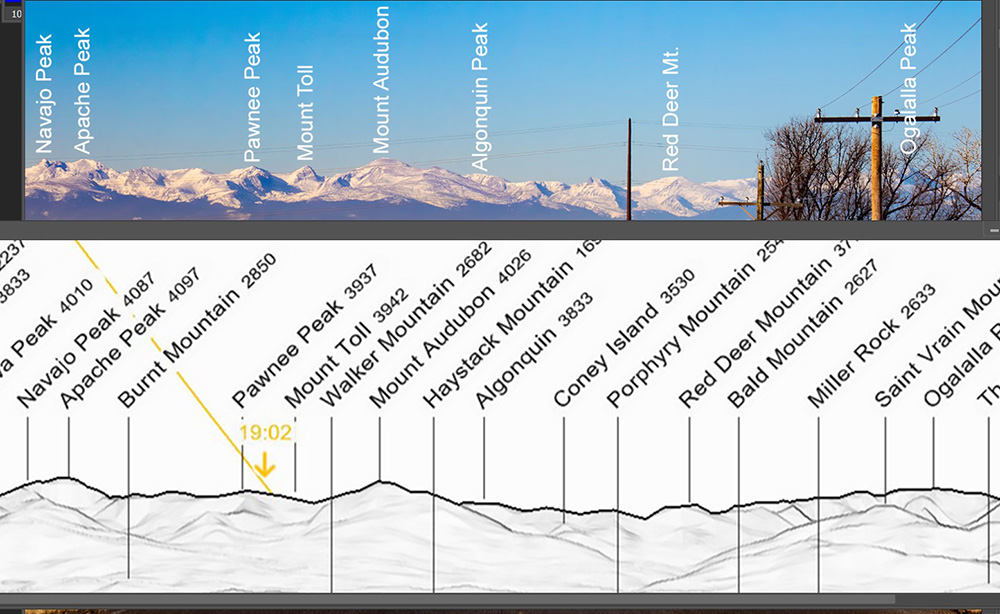
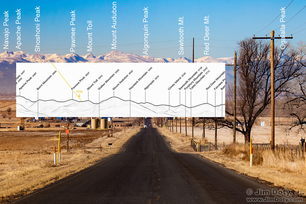
I zoomed in on PeakFinder until the mountains in Peak Finder were a better match to the mountains in my photo. I did a screen capture of PeakFinder and put the screen capture in an overlay right on top of my photo to line up the mountains. The PeakFinder line drawing is not as detailed the mountains in my photo. Just to be sure I had the right mountains, I did a Google image search, starting with Navajo Peak and Apache Peak on the left, to make sure they were the same mountains as the ones in my photo. Once I was sure, I labeled the mountains in my photo using the type tool Photoshop.
PeakFinder did not name some of the mountains in my photo. So I zoomed in some more on PeakFinder so it would show me more names, and then I did another comparison overlay and added those names.
It is usually not this complicated to use PeakFinder because most of my photos don’t have so many mountains in them. I drop the GPS coordinates from a photo into PeakFinder and it is immediately obvious what the names of the mountains are. But this photo had so many mountains it was a more complex process.
This is my final labeled image. I always keep the original, unlabeled image too. I don’t usually label my mountain images, but when I do and I don’t know the names of the mountains, PeakFinder is a huge time saver.
The Front Range extends well to the south of this image, and also farther north. I took several overlapping images from this location just in case I want to do a panorama some day.
Links
How do you figure out the names of the mountains in your photos? – a simpler example

