

Ludington Dunes in the moonlight. Click the image for a larger version.
My primary camera, a DSLR, does not record the GPS location of my photos. Why does it matter? Some photo editors will not publish a photo unless you provide accurate GPS coordinates of the image location. Of course I knew I was approximately a couple of hundred yards up the beach from the parking lot, but not precisely where I was. Plus I am curious. Some of my photos are taken in less obvious locations and I like to know where I was when I clicked the shutter.
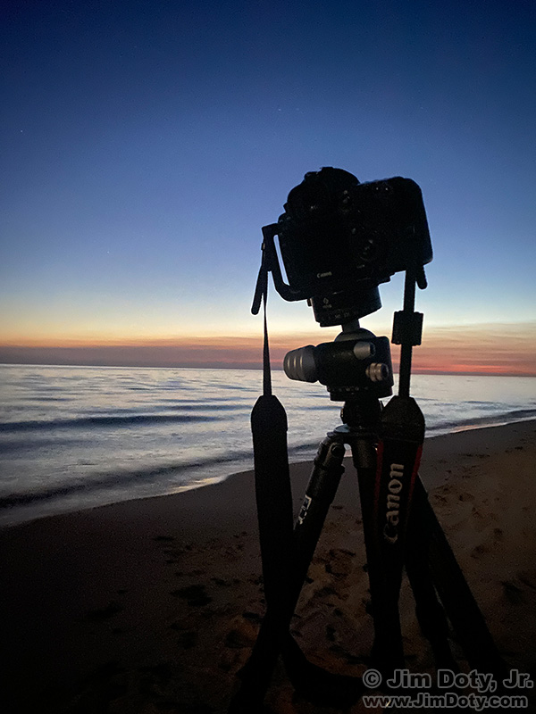
iPhone photo of my DSLR.
When I want to know my GPS location, I have two quick and simple ways to check. First, I take a photo of the same location with my iPhone because it records GPS locations. When I do this I often include my camera in the photo of the location.
My goal was to photograph the stars over Ludington Beach in the moonlight, so I took my iPhone photo of my camera location before it got dark. In case you are curious, I did level the DSLR before taking the beach pictures!
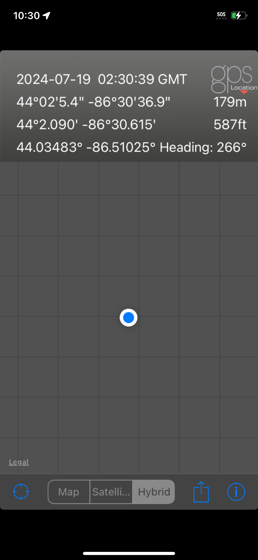
GPS Location app.
Second, I have the “GPS Location” app on my phone. I turn it on and do a screen capture of the location app. Both the camera and the location app are using my phone to get GPS coordinates, but for some reason, sometimes the camera gives me wonky results.
My third option is to get out my secondary DSLR, put on a lens, and take a picture. It records GPS coordinates with the photos. But this option is more cumbersome and time consuming than just using my phone.
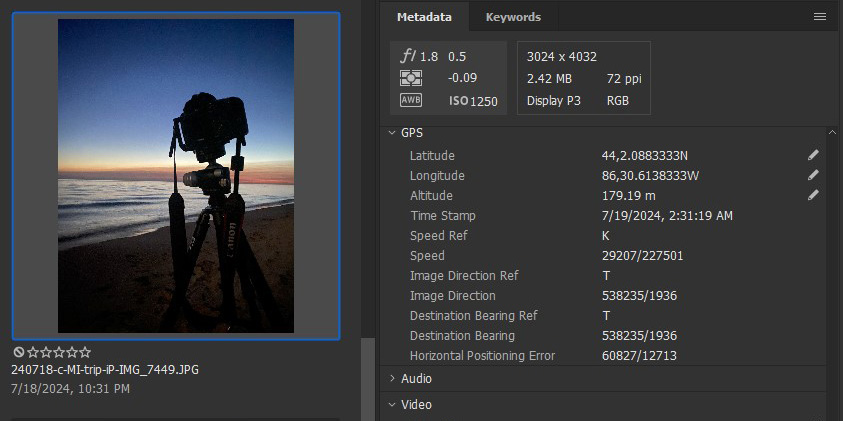
Adobe Bridge: iPhone photo on the left and the GPS location on the right.
Back home I make sure the iPhone photo GPS location agrees with the GPS Location app location. They usually do. If they don’t agree I put both sets of coordinates in a satellite map on Google Earth Pro (a free download) to see which set of coordinates makes the most sense. In the case of my Ludington Dunes location, the iPhone photo GPS coordinates agree closely with the GPS Location app coordinates.
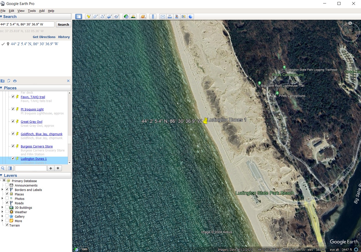
Google Earth Pro: Both GPS locations marked with yellow pins. Click the image to see a bigger version.
I dropped both sets of coordinates into Google Earth Pro and they are within a few feet of each other. Since consumer grade GPS satellite coordinates are accurate to within 30 or so feet, a few feet of difference between the coordinates is pretty good.
iPhone apps.
The GPS Location app is the 2nd from the left in the top row. Next to it is the Compass Commander app. It is a digital compass and it also provides GPS coordinates at the top of the compass screen. Compass Commander gives you yet another way to check your GPS coordinates.
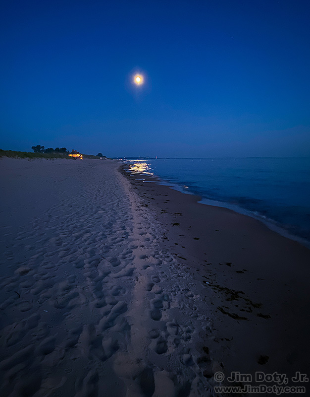
Moon over the beach. iPhone photo.
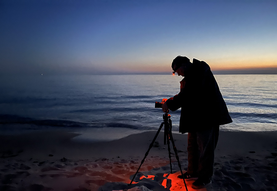
Jim Doty, Ludington Dunes. Photo by Anoush.
Tip: I carry a red headlamp for doing things when it gets dark. Red light does not mess up the dark adaption of your eyes. If you use white light, like a flashlight, it messes with your dark adaption and it will take your eyes 20-30 minutes to acquire full dark adaption again. Some people have a red filter that fits over the front of their flashlight. I like a headlamp because it leaves both of my hands free.