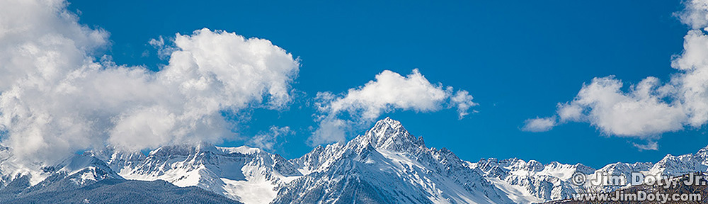

Mt Sneffels and the Sneffels Range from County Road 7 (Dallas Creek).
Mt. Sneffels is one of the most photographed peaks in Colorado. One of the best locations to create some images is along County Road 7 (Dallas Creek).
Drive about 4 miles west of Ridgway Colordo on CO 62 and look for the Dallas Creek sign. Turn left and drive south about 7 miles. You won’t see much along the way but have faith. At mile 7 you will come around a short curve to the left and a lovely valley will open up below you with expansive views of Mt. Sneffels. This is private land so do not leave the road to go down into the valley or climb up on the hill above the road.
There are several good photo locations along this stretch of road which makes a long curve to the right. Just pick a spot, park along the roadside and create some beautiful images. Once you cross the cattle guard and the road enters national forest land, the sweeping scenic views are over, but there are still some good forest photos to be had along the last stretch of road.
The photo above was taken near the cattle guard at the end of the long curve and very close to the border between private and public land
Most years the aspen are turning from green to gold from the end of September through the first week in October, so the first week of October is usually good time to go. This photo was taken October 3.
GPS Coordinates
Latitude: 38° 3′ 28.818″ N
Longitude: 107° 48′ 25.116″ W

Ridgway Colorado, CO Highway 62, and County Road 7
This area map shows Ridgway Colorado, CO Highway 62, and County Road 7.

Photo location along County Road 7.
This close up map shows the ideal stretch of road to take pictures beginning with the short left curve (as you are heading generally southeast) which turns into the long right curve leading up to the photo location at the cattle guard. The creek on this map just to the west of the road runs through the valley in the photo.
Photo Data: Canon 5D Mark III. Canon EF 17-40mm f/4L USM lens at 40 mm. 1/60 sec, f/11, ISO 100.